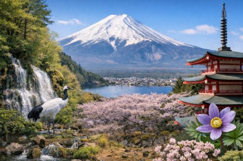
Mount Fuji’s spiritual pathways extend beyond its well-known climbing routes to include two unique pilgrimages: the mid-slope “Ochudo” circuit and the summit crater “Ohachi-meguri.” This guide focuses on the latter-the awe-inspiring journey around Fuji’s volcanic caldera, a practice deeply rooted in the mountain’s religious heritage.

The Ohachi-meguri Route
The 3-kilometer crater rim path circles Fuji’s 800-meter-wide, 200-meter-deep summit caldera. Historically part of Fuji faith practices, this route begins at Kusushi Shrine (the traditional summit marker for Yoshida and Subashiri trails) and proceeds clockwise through eight sacred peaks:
-
Dainichi-dake (Modern: Asahi-dake)
-
Amida-dake/Kannon-dake (Izuga-dake)
-
Seishi-ga-take (Jōju-ga-take)
-
Sengen-taisha Okumiya (Shinto shrine complex)
-
Sen-ga-dake (Koma-ga-dake)
-
Monju-ga-take (Mishima-dake)
-
Ken-ga-mine (Summit’s highest point at 3,776m)
-
Shaka-ga-take (Shirane-san)
Bold names reflect pre-Meiji era designations changed during Haibutsu Kishaku (anti-Buddhist policies). Parentheses show current official names.
Spiritual Significance
The circuit embodies Fuji faith’s syncretic Buddhist-Shinto traditions:
-
The eight peaks represent lotus petals surrounding the caldera’s “inner sanctum,” symbolizing Dainichi Nyorai (Cosmic Buddha)
-
Pilgrims historically chanted at each peak to honor associated deities, a practice called “O-hachi-meguri” (Eight Circuits)
-
Modern hikers follow this “crater circuit” (Ohachi-meguri) while admiring geological marvels like:
-
Raijin-iwa (Thunder Rock): Volcanic bomb with lightning-strike marks
-
Shaka-no-warishi: Split boulder resembling Buddhist statues
-
Kinmei-sui/Ginmei-sui: Gold/Silver Springs-iron-rich seeps venerated as sacred waters
-
Trail Conditions & Key Landmarks
Western Section (Kusushi Shrine to Ken-ga-mine)
-
Aramaki Area: Yellow-white lava fields with fumarole scars from pre-WWII activity
-
Jōju-ga-take: Offers views of Osawa Gully’s ongoing erosion
-
Ginmei-sui Spring: Junction with Gotemba Trail, site of Fuji’s highest post office
Eastern Section (Ken-ga-mine to Shirane-san)
-
Umanose Ridge: Narrow path requiring careful footing
-
Kengamine Peak: Japan’s highest survey point (3,776m)
-
Raijin-iwa Detour: Bypasses unstable slopes near Thunder Rock
Northern Loop Options
-
Inner Route: Passes Kinmei-sui Spring’s rust-colored pools
-
Outer Route: Showcases Osawa Gully’s headwall (closed during heavy rains)
Practical Considerations
-
Duration: 1.5-2.5 hours (add 30 mins for photography/stops)
-
Challenges:
-
150m elevation change despite being a “rim” trail
-
Thin air (summit O₂ levels ≈ 60% of sea level)
-
Sudden weather shifts common above 3,500m
-
-
Facilities:
-
Toilets available only at Fujinomiya Trail side until July 10
-
Mountain huts offer oxygen cans and basic supplies
-
Cultural Insights
-
Meiji Renaming: Buddhist peak names (e.g., Dainichi-dake) were replaced with secular terms post-1868
-
1930 Discovery: The Mishima-ga-take Sutra Mound revealed 14th-century Buddhist texts, proving late medieval pilgrimage activity
-
Modern Rituals: Hikers still leave coins at Kinmei-sui/Ginmei-sui as offerings to Sengen deities
While reaching Kengamine satisfies most climbers, completing Ohachi-meguri offers unparalleled perspectives on Fuji’s spiritual and geological grandeur. Check trail status via the Yoshida Trail Office before attempting, and prioritize safety over completion-this sacred circuit remains as challenging today as when Edo-era pilgrims first mapped its wonders.


