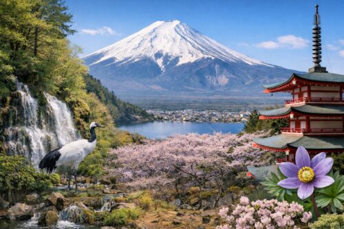
Today, we’ll continue learning about Mount Fuji, focusing on its spring water.

Mount Fuji’s Annual Precipitation
The annual precipitation on Mount Fuji is estimated to be around 2 to 2.5 billion tons, which is equivalent to the annual water consumption of Tokyo’s residents (about 2 billion tons). This amount is truly astounding.
Water Absorption and Spring Formation
Most of this water doesn’t flow down the mountain’s surface but is absorbed into the ground, eventually emerging as springs at the foot of the mountain. This phenomenon is due to the porous nature of the volcanic materials covering the current Mount Fuji, such as basaltic lava and scoria, which easily allow water to penetrate. The water seeps through until it reaches the less permeable Ko-Fuji mudflow layer, then flows along the slope and emerges as springs at the mountain’s base.
Notable Spring Water Sites
Several well-known spring water sites surround Mount Fuji, including:
- Oshino Hakkai: A World Heritage Site and part of Mount Fuji’s cultural assets
- Wakutama Pond: Located within the Fujisan Hongu Sengen Taisha shrine, also a World Heritage Site
- Kakita River Springs: Boasting the largest spring water output in the East
- Shiraito Falls: Where water from lava layers flows as a waterfall
Countless springs, both famous and small, are scattered around Mount Fuji’s vicinity.
Wakutama Pond

Located within the Fujisan Hongu Sengen Taisha shrine in Fujinomiya City, Shizuoka Prefecture, this is the largest spring water site on Mount Fuji’s western foot. About 30 tons of water emerge daily, flowing into the Kanda River. The water temperature remains constant at 13-15°C year-round. Historically, it was used for purification rituals by Mount Fuji climbers and was revered as “sacred water” during the Edo period when the Fuji-ko cult flourished.It’s said that rainwater and snow falling on Mount Fuji’s summit take about 15 years to reach Wakutama Pond, traveling approximately 20 km.
Kakita River

Located in Shimizu Town, Sunto District, Shizuoka Prefecture, this is a tributary of the Kano River, about 40 km from Mount Fuji’s summit. At 1.2 km, it’s Japan’s shortest first-class river and is counted among Japan’s three clearest streams along with the Nagara and Shimanto Rivers.The daily spring water output exceeds 1 million tons, with an average water temperature of about 15°C year-round and minimal water level fluctuations. This abundant spring water is used for local industrial and drinking water, supplying not only Shimizu Town but also Numazu City, Mishima City, and Nagaizumi Town.
Oshino Hakkai

Situated in Oshino Village, Minamitsuru District, Yamanashi Prefecture, Oshino Hakkai is part of the Mount Fuji World Heritage Site. Interestingly, each of the eight ponds is individually registered as a World Heritage Site. The area, including Oshino Hakkai, was once part of a massive lake called Lake Utsu. A major eruption of Mount Fuji in 800 CE divided the lake into Lake Yamanaka and Lake Oshino. Eventually, Lake Oshino dried up, leaving eight spring water outlets that became Oshino Hakkai.The pond with the highest spring water output is “Waku-ike,” producing about 230,000 tons of water daily. The combined output of the other seven ponds is only about half that of Waku-ike.
Conclusion
Mount Fuji’s spring water also emerges in other locations such as Shiraito Falls and the Fuji Five Lakes. It even reaches as far as Suruga Bay, appearing as submarine springs. The abundance of information available just on the topic of “spring water” truly demonstrates why Mount Fuji is Japan’s most iconic mountain.