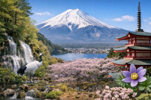
When you gaze at Mount Fuji in winter, you’ll notice two distinct bands:
– A brilliant white upper zone, where thick snow blankets the mountain’s upper slopes.
– A darker, bluish lower zone, where evergreen forests hide the snow beneath their canopy.

The clear boundary between these two color bands is known as the forest line. In summer, when the snow melts, the upper slopes reveal reddish-brown lava rock, while the forested zone remains green.
In this article, we’ll explore the concepts of the forest line, the tree line, and how they apply to Mount Fuji’s unique environment.
-
Definitions
• Forest Line (Ecotone): In subalpine regions like Mount Fuji, the forest line sits at about 2,400 m above sea level. Below this altitude, continuous stands of conifer trees form a dense forest. Above it, tree height gradually declines to a point where the canopy breaks, giving way to low shrubs, grasslands, scree, and bare rock. Botanists often define the forest line as the elevation where mature trees no longer exceed a certain height (typically 3–5 m, depending on the researcher).
• Timberline (High-Tree Limit): Above the forest line, trees survive only in scattered clumps and seldom grow upright. This elevation marks the timberline.
• Tree Species Limit (Absolute Tree Line): Higher still is the limit beyond which no trees—even in stunted form—can survive. On Mount Fuji’s western flank (the right bank of the Ōsawa gully below Kengamine Peak), the forest line is around 2,800 m and the tree species limit about 2,900 m. -
The “Battle Zone” Above the Forest Line
Beyond the forest line lies the so-called “battle zone,” where plants struggle against strong winds, intense sunlight, freezing temperatures, and shallow soils. This zone also represents the transition from subalpine forest to alpine grassland. -
Variations Caused by Eruptions
Historical eruptions have left patches of ash and pumice that inhibit tree growth, so the forest line on Fuji varies widely:
– Highest recorded forest line: ~2,800 m on the western slope.
– Lowest recorded forest line: ~1,300 m on the southeast flank (from Gotemba to Subashiri), where the 1707 Hōei eruption deposited thick volcanic deposits.
The theoretical maximum forest line for Mount Fuji is about 2,930 m, meaning even the highest forests today have not yet reached the mountain’s climatic limit.
-
The Forest Is Advancing
Studies suggest that on Fuji’s south slope, the forest line has risen by roughly 100 m over the past century. If volcanic activity remains quiescent, the western forest could reach its theoretical limit in another 100–200 years. At the current rate of 100 m per 100 years, in about 500 years Mount Fuji might be largely cloaked in forest rather than the iconic stark cone we know today. -
Ecological Implications
A rising forest line would transform Fuji’s ecology:
– Alpine grasslands and their specialized plants would shrink, replaced by subalpine trees and shrubs.
– Wildlife adapted to open, rocky zones would lose habitat, while forest-dwelling species could expand uphill.
Monitoring these changes offers a living laboratory in climate-driven vegetation dynamics and helps us understand how mountain ecosystems worldwide may respond to warming temperatures.
By watching where green gives way to white on Fuji’s slopes, we’re seeing the frontier of life itself—the invisible boundary where trees can no longer thrive. As that line marches uphill, it tells a story of environmental change playing out on Japan’s most famous peak.


