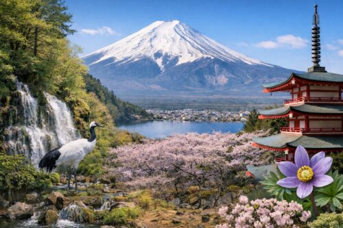
Today, we’ll be learning about Mount Fuji’s volcanic nature. While I’ve previously touched on Mount Fuji’s formation, it’s worth remembering that the mountain we recognize today—known as “New Fuji Volcano”—was formed through repeated eruptions over many centuries.

An Active Volcano in Dormancy
Mount Fuji is an active volcano. Its last eruption occurred approximately 300 years ago—the major Hoei eruption of 1707. Though it hasn’t erupted since then, Mount Fuji remains classified as an active volcano. By definition, an active volcano is one that could potentially erupt in the future and has either erupted within the past 10,000 years or currently shows signs of volcanic gas activity.
Therefore, despite its current quiet state showing no signs of eruption, Mount Fuji is still expected to erupt again someday. Currently, Japan recognizes 111 volcanoes nationwide as active.
Understanding Volcanoes and Magma
A volcano is a landform created when molten rock (magma) from beneath Earth’s surface reaches the surface, expelling magma and rock fragments to create elevated terrain.
On Earth, magma activity generally occurs in three main settings:
-
Mid-ocean ridges: Where new tectonic plates form. These produce the largest volume of magma but remain largely unseen as they’re mostly located on ocean floors at depths of around 3,000 meters.
-
Hotspot volcanoes: Formed within tectonic plates, like those in Hawaii.
-
Subduction zone volcanoes: Formed where one tectonic plate slides beneath another (at plate boundaries). These include the “Ring of Fire” volcanoes in Japan, Kamchatka, the Aleutians, western North America, western South America, Indonesia, and the Philippines.
In subduction zones, water from oceanic plates helps rocks melt at relatively lower temperatures, creating magma. This results in vigorous volcanic activity, with magma containing several percent water, making explosive eruptions more likely. The presence of water significantly influences magma behavior, eruption patterns, and the development of these volcanoes.
Mount Fuji’s Unique Magma
Unusually for Japanese volcanoes, over 99% of Mount Fuji’s magma is basaltic. Most other Japanese volcanoes feature andesite or dacite magma.
The reason for Mount Fuji’s basaltic composition lies in the depth of its magma chamber—more than 20 kilometers below the surface. When magma chambers are 10 kilometers or shallower, magma cools and releases crystals, changing its chemical composition to andesite or dacite. However, with deeper chambers like Mount Fuji’s, different types of crystals form, allowing the magma to remain basaltic despite compositional changes.
While the technical details may be complex, the key takeaway is that Mount Fuji’s magma chamber is exceptionally deep compared to other Japanese volcanoes.
Additionally, the eruption rate of Mount Fuji’s magma has been 10 times higher than other Japanese volcanoes! This explains how it achieved its impressive volume of 400-600 cubic kilometers and height of 3,776 meters in the relatively short geological timespan of 100,000 years, becoming Japan’s tallest mountain.
What If Mount Fuji Erupted Today?
Scientists have modeled potential scenarios for a modern eruption of Mount Fuji. If an eruption similar to the 1707 Hoei eruption occurred today:
-
The Tokaido Shinkansen (bullet train) tracks from Odawara to Yokohama would be buried under more than 20 cm of volcanic gravel and ash, halting operations.
-
Conventional railways like the Tokaido Line would face similar issues.
-
Highways such as the Tomei Expressway would become impassable due to ash accumulation.
-
A vast area from Mount Fuji to the Tokyo metropolitan region would lose transportation functionality.
-
Aircraft would be unable to fly through ash clouds.
-
Agriculture would suffer significant damage.
During the 1707 eruption, there were no direct casualties from the eruption itself. However, farmland became unusable, and subsequent rainfall caused mudslides and floods, resulting in many deaths from starvation and numerous missing persons. While modern infrastructure might prevent similar outcomes, we would likely face different but equally significant challenges.
Monitoring and Preparedness
To prepare for potential eruptions, Mount Fuji and other volcanoes undergo extensive monitoring, eruption prediction research, and hazard mapping.
Japan’s volcanic monitoring history spans over 100 years, employing various techniques to track magma movement:
-
Seismic monitoring to detect earthquake activity around volcanoes associated with magma movement
-
Volcanic crustal deformation monitoring to observe changes in mountain shape due to magma volume changes or movement
-
Gravity monitoring
-
Geomagnetic monitoring
Mount Fuji has multiple monitoring devices installed, particularly from its southeast to northwest regions where many eruption traces remain. The Japan Meteorological Agency monitors these systems 24 hours a day for any signs of volcanic activity.
Additionally, hazard maps—specifically the Mount Fuji Volcanic Disaster Prevention Map—have been published to help protect people from volcanic eruptions. These maps show:
-
Areas that could be reached by lava flows or large volcanic bombs
-
Regions potentially affected by pyroclastic flows and hot ash-laden winds
-
Historical disaster zones
Evacuation route maps for municipalities surrounding Mount Fuji are also available for reference.
Conclusion
For now, Mount Fuji shows no signs of imminent eruption and remains safe to climb. However, we should never forget its nature as an active volcano. It’s crucial to understand volcanic behavior and familiarize ourselves with evacuation routes in advance—knowledge that could prove vital for ensuring personal safety should an eruption occur.


